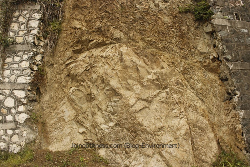
Earthquake Cracks in Bedrock between Retaining Walls in Content Gap, St. Andrew, Jamaica.
Overview-Earthquake Hazards Project, Jamaica
Jamaica is no stranger to earthquakes.
Considering that Jamaica has a history of experiencing strong earthquakes on the mainland, there is no doubt that Jamaica, will more than likely experience a large one in the near future. How we build as a nation, can go a far way towards mitigating losses (numbers) in life. On this basis alone the need for a project and report like ours, is needed. Through our year-long project, we share applicable and in some respects, actionable tips & insights, for Jamaicans (all walks of life), to apply. As you benefit from our report(s), we urge you to share with your fellow community.
Note Briefly-Our Report(s) Don’t Supersede Recommendations Given By Contracted Professional/Authorities
Whilst the information shared can be applied to your community, and potentially, your home, You’re urged to contract a professional geologist, and/or follow the guidelines of the relevant authorities. Should you want to engage with myself (as a Geologist), you may contact me at oshanebryant@gmail.com
Environment- Guava Ridge to Clydesdale, St. Andrew, Jamaica


Population Estimation-Guava Ridge to Clydesdale
with an approximation of 40 built properties observed within a 400m x 100m area. And given an approximate length of 7.6km, The approximate total number of built properties within this area is 760. And at 2 persons per household, the approximate total of residents within this location is 1520.
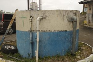
Critical Infrastructure Observed
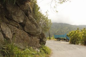
- One main road connecting Content Gap with Ginger Piece, and Guava Ridge communities; and Portland via Silver Hill.
- 2 Bridges
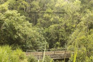
Bridge connecting Content Gap with Silver Gap Thorougfare
- National Water Commission, Pumping Station in Content Gap Sq.
General Geology in Images & Videos
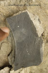
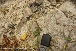
Mudstone
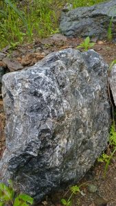
Blueschist with Calcite Veins
Granodiorite/Granitoid
Felsic-Intermediate Volcanic Rock

Pillow Basalt Volcanic Rock
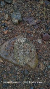
Cooked Limestone
Black Marble
Geologic Maps of Guava Ridge to Clydesdale, St. Andrew, Jamaica (non-digitized)
Note Briefly: the maps herein are for general education purposes only.


Earthquake-Related Hazards (with Images where applicable)
- RockFall (Boulders over 1m diameter).
-
Jointed Boulders sloping to road
 Debris Slide
Debris cleared from road. Landslide Slope Face
- Road Block (Debris)/Damage & Marooning.
- Flooding (Earth movement and/or Subsidence).
- Water Pipe Damage due to debris movement.
Engineering-Relevant Geology (based on field observations)
Soil Type & Rock Type
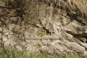
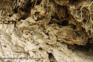
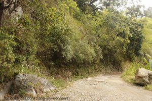
The area is dominated by Silt-Clay Soil. And the rocks are generally highly jointed, fractured (faults, roots) & and weathered. Therefore, the rocks of this area are classified as weak, and the soils, are likely to be expansive.
Drainage
Using Google Satellite Imagery, as reference, with an approximate road length of 6km from Guava Ridge- Clydesdale intersection, there are at least 8 sections of drainage points from the Hill slope to the road.
Rainfall
With it’s location on the outer skirts of The Blue Mountains, Rainfall is no stranger to this location. Therefore, Landslide/Creep susceptibility will be high. Likewise, road damage. Appropriate design with drainage to the nearby river is needed.
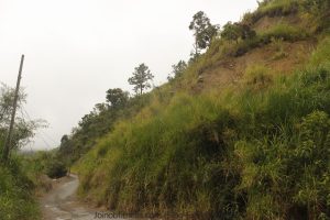
Slope Angle
Slopes measured average 50 deg -70+ deg. In other words, the slopes that are adjacent to the main road, need retention support (retaining wall; meshing). Doing so, can reduce the incidence of roadblocks due to debris.
Earthquakes
A section of a fault generally at a North-South trend measure 3km+ in length. And given the location near to the Blue Mountain Inlier (tectonicallly active zone in Jamaica), Earthquake frequency of light to moderate in intensity/magnitude is common (6-10+ annually). Therefore, ensure the bridge and other critical infrastructure are sound through regular checks and/or maintenance (once annually), is recommended. Likewise, houses are to be built on foundations best suited for tectonicallly active zones; weak bedrock, and/or expansive soils; high slope angle; and high rainfall areas.
Additional/Specific Actionable Information (Including Economic Geology)
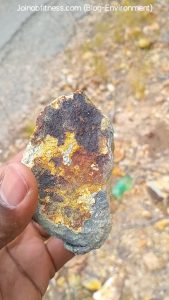
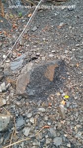
Iron & Copper Skarn on Andesite-Basalt
Multiple Iron and Copper mineralization zones were observed (Content Gap-Clydesdale Intersection). These mineralizations give cues of earthquake influence on their deposition. These zones also give cues of mineral deposits along the fault(s) aligning the river.
Pillow Basalt with Copper Zones (Green Hue)
Earthquake Faulted with Copper Zone between 2 Blocks of Strata.
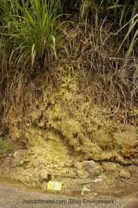
Mineral Spring-potentially Copper, Iron, Sulphur
Project Ongoing-Earthquake Hazards in Jamaica (June 2026-March 2027)
Please Donate
https://www.paypal.com/ncp/payment/VWY7JZZTS3ARW