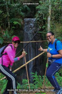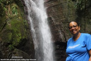
It was a day filled with hiking, adventure and laughter…
Sums up as a day well spent, if I’d say so myself.
From the bus journey, to our tour on foot, the vibes was right.
Behold, some of the videos & photos that highlight some of the overall experience; and serve as timeless memories.
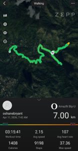
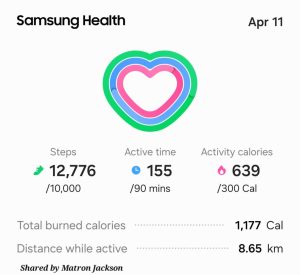
Active Calories Burnt | Terrain (Bowden Hill)
With an approximate hiking distance of 7-8km, the estimated active calories burnt was 1000-1400. This is approximately half of 1lb. The terrain gradient ranged from flat to moderately steep (30%-40%), making this hike a relatively easy-moderate one.
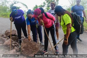
Geology: Bowden Hill Rd-Bowden Hill
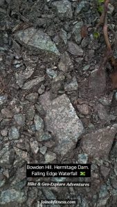
Whilst thorough mapping of the Stony Hill to Bowden Hill area was covered by us prior (Click Here), we happened to miss a zone of Granitoid before crossing the bridge on Bowden Hill Rd.
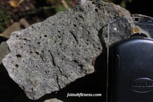
Vesicular Volcanic (Potentially Andesite)
This zone of granitoid displayed significant fracturing with a trend of NNE/SSW. We came across another rock type (volcanic) that highlights vesicular texture. This was observed at The Falling Edge Waterfall.
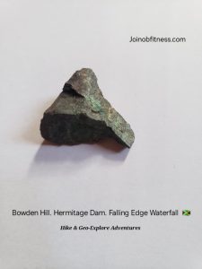
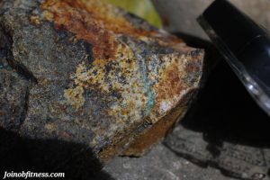
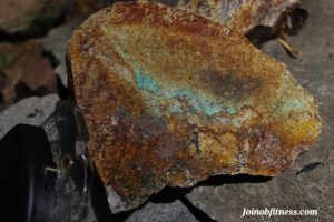
Mineralization & Minerals Observations-Bowden Hill
Copper & Iron Mineralization were observed throughout the trail. And the hikers were highly engaged.
Below are some images
Earthquake Zone Exposure & Brief Structural Geology Education
Fresh rockfall were observed, and there were clean outlines of fault lines on rocks. The hikers got the chance to interact and learn.
Observing slickensides-earthquake movement proof
As shared by a couple of the hikers, this is how they felt about the experience: