Affiliate Links Notice: We have included affiliate links in this blog article. Should you click on the respective link(s) and make a purchase, we will receive a commission.
Mile Gully Mountain and surrounding communities as a landscape, is one of Agriculture & Sightseeing. Whether you choose the touring method of hiking, bicycling, or motor vehicle, you’re sure to have an awe-inspiring & eco-fulfilling experience.
In this blog post, we share some environmental & economic insights of Mile Gully Mountain, Contrivance & Walderston communities, through our first hand experience.
Mile Gully Mountain, Contrivance & Walderston- Geography Facts
Located in Manchester, Jamaica in a predominantly westerly direction relative to Walderston (general entry point), and extending south-easterly for approximately 4.5km in length, Mile Gully Mountain, otherwise known as ‘Top Hill’ by locals, has a highest point of approximately 960m above sea level.
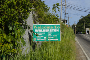
Walderston–Sign of Directions (includes ‘Top Hill’).
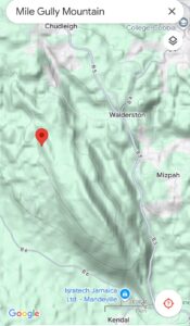
Google Terrain Map of Mile Gully Mountain
Rocks That Make Up Mile Gully Mountain & Adjoining Communities
The rocks that make up Mile Gully Mountain and the adjoining communities of: Walderston, Chudleigh, Contrivance & others, are Carbonate in nature. At the outcrop scale, these rocks appear grey-white & pink-grey-white. At hand-sized scale, fossils such as benthic foraminifera & bivalves can be seen. Crystals (potentially Calcite) can be seen, and holes: primary indicator & causative factor of caves, depressions/sinkholes & solution dolines at landscape scale. In terms of the geologic history of these areas, the fossils & general lithology this landscape, depict a depositional environment originating in the sea (relatively deep to shallow water regions).
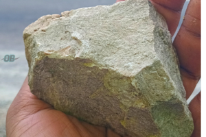
Hand-Sized Rock of Mile Gully Mountain. At this scale some samples appear as limestone mud, and others show potentially calcite crystals.
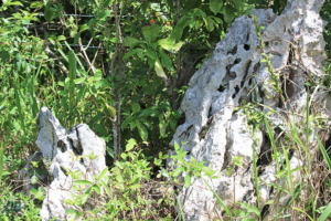
Outcrop scale of rocks that make up Mile Gully Mountain. Notice the holes? These contribute to sinkholes/depressions & caves at larger scales.
Sinkhole or Depression observed at Walderston, Manchester Jamaica.
Bauxite Soil
The color of the soil at the landscape scale (Walderston-Mile Gully Mountain) is Orange-Brown to Red. This soil has a clay texture. It’s because of this soil type why the Windalco Bauxite Mining Company is located relatively close by.
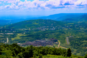
Windalco Bauxite Mining Company. Captured from Mile Gully Mountain
Join our Upcoming Excursions. Click Here
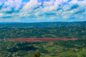
Windalco Bauxite Mining Company, Residual Lake. Captured from Mile Gully Mountain.
Agriculture- Major Economic Activity of Mile Gully Mountain & Surrounding Communities
Geo-Determinants of Widespread Agriculture & Observed Agricultural Practice(s)
At the landscape scale, karst topography dominate. It is at this scale you will see widespread hills & depressions–solution dolines.
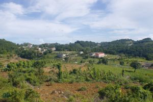
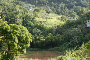
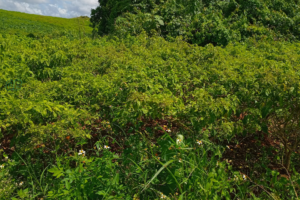
Landscape Farming view of Contrivance, Manchester Jamaica
Agriculture as captured by the author throughout the observation areas of Walderston-Contrivance-Mile Gully Mountain, is a dominant economic activity of community members.
Livestock (Cattle such as the Jamaica Red); and Crops such as Yam (potentially yellow yam); Sweet Potato and Vegetables–Scotch Bonnet Pepper & Tomatoes were observed as the dominant economic agricultural practice.
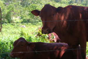
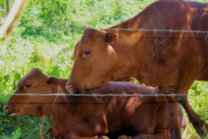
Jamaica Red Cow with Calf on Farm at Mile Gully Mountain.
Yam Farm in Walderston, Manchester Jamaica
Scotch Bonnet Pepper Farm on Mile Gully Mountain, Manchester Jamaica
Vulnerability of Agriculture at Mile Gully Mountain & Surrounding Communities to Natural Disasters
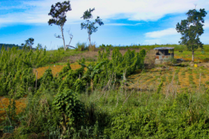
Vulnerability of Agriculture at Mile Gully Mountain & surrounding communities to natural events (disasters) such as hurricanes, is highlighted through the captured image of a damaged farm house located on the hill side at Contrivance.
It’s likely that this damage was caused by Hurricane Beryl (July, 2024) a Meteorological event that caused extensive widespread damage to Jamaica’s Agricultural sector–specifically within the parishes of St. Elizabeth & Manchester; and resulted in massive financial losses of the sector and communities-potentially including Contrivance-Walderston.
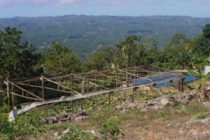
Damaged Farm House located in Contrivance, Manchester Jamaica.
Similarly, the observation of artificial catchment of water on farmlands on Mile Gully Mountain, gives an indication of drought challenges experienced by farmers. The nature of the rocks (holes) that underly the soils within this region support low water retention/surface water access. This in extension can be inferred to contribute to drought conditions farmers can experience during dry season(s).
Join our Upcoming Excursions. Click Here
Hiking Experience: Contrivance-Mile Gully Mountain
Hiking from Contrivance, Manchester-Mile Gully Mountain, and back, was approximately 10.98km in distance; and was predominantly moderate in terms of subjective difficulty, with relatively 200m-300m of challenging hills to climb over. In total it was roughly 3.5 hours of hiking, mapping & sightseeing.
Below are additional photos & videos capturing the Hiking & Mapping experience of Walderston-Contrivance-Mile Gully Mountain.
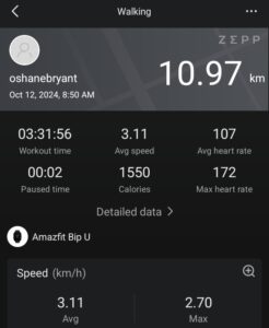
Physical Activity Stats of Hike (Contrivance-Mile Gully Mountain x2) Captured by Amazifit Smart Watch.
Earthquake Fault Slip Plane? Captured at Contrivance, Manchester Jamaica. Book is used for slip plane reference & scale.
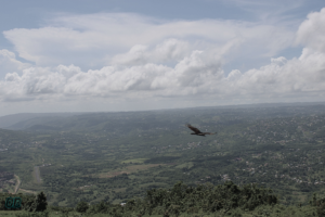
Vulture in Flight. At Mile Gully Mountain, Manchester Jamaica.
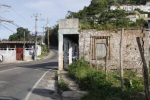
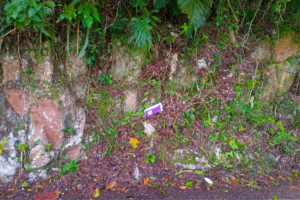
Relic of Building Pre-Independent Jamaica. Located in Walderston, Manchester
If you decide to book a stay at a nearby resort or villa, in Manchester: hiking and/or exploring Mile Gully Mountain & surrounding communities, should definitely be added to your “Things to Do in Manchester, Jamaica” list.
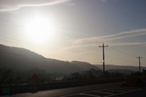
Sunrise at Williamsfield Highway: Manchester, Jamaica
Fulljoy.
About The Author

Oshane Bryant: BSc Geology, Geography Minor; ACE CPT since 2012; Jamaica Business Development Corporation (JBDC) Accelerator Graduate-2018 cohort; Licensed KUKIBO Martial Arts & Self Defense, Senior Instructor; CSA Certified Executive Protection; OB Fitness Founder & Managing Director.