
single post
Subscribe to receive all updates on O’Shane Bryant Fitness Limited.

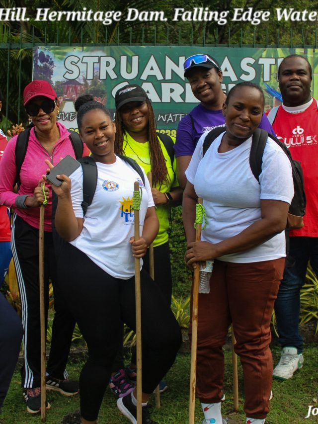

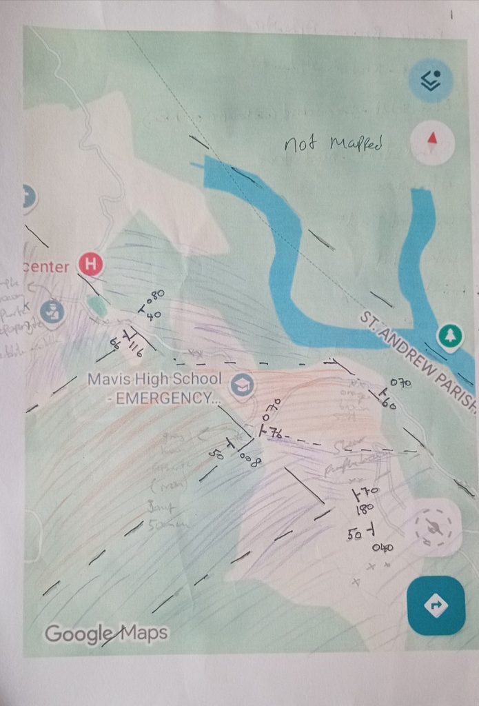
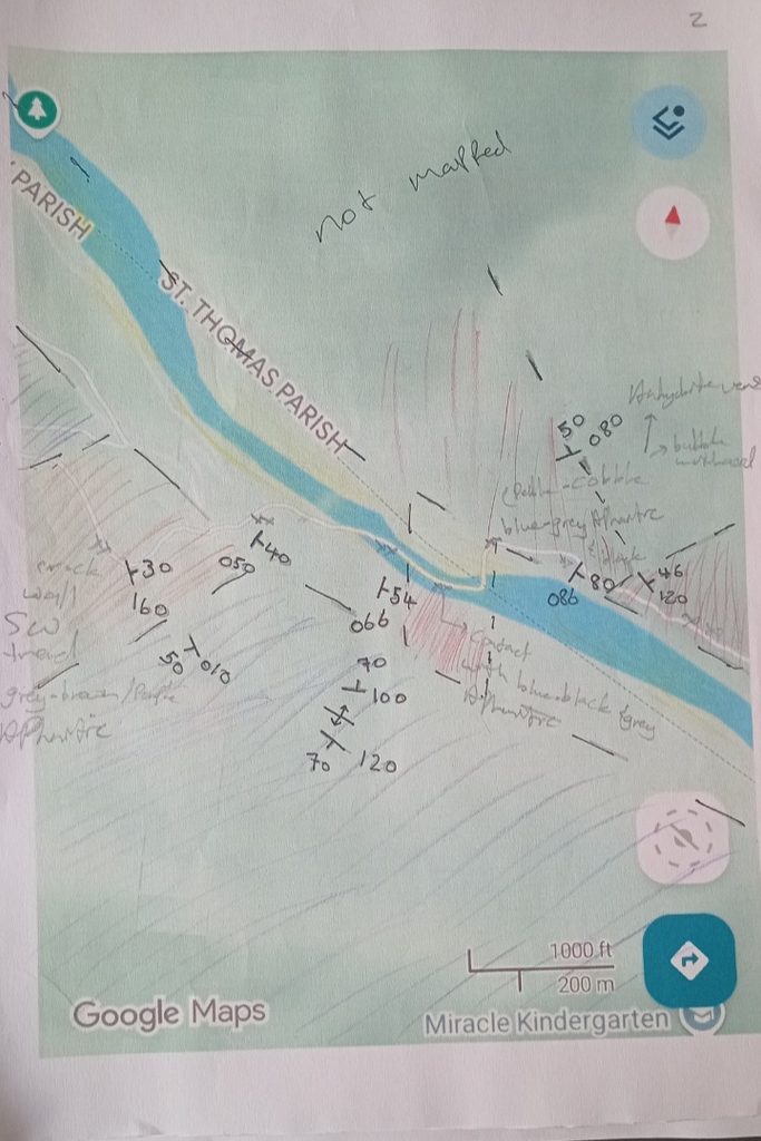
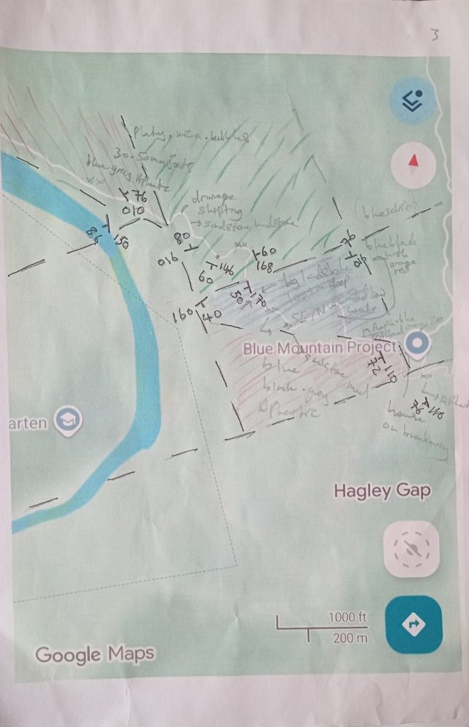
Field geological mapping of Hagley Gap-Cedar Grove (primary focus), occurred via hike on October 3, 2026. The route began at Mavis Bank, St. Andrew, and included traversing Mavis Bank High School, to the:
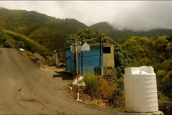
Whilst traversing, macroscale geology, structural geology (predominantly strike & dip), geomorphic features, infrastructure (public & private), as well as geotechnical-relevant considerations were recorded. For the most part, geomorphic & related infrastructural photographs related to this mapping endeavor, can be observed: In Photos (Click).
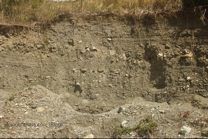
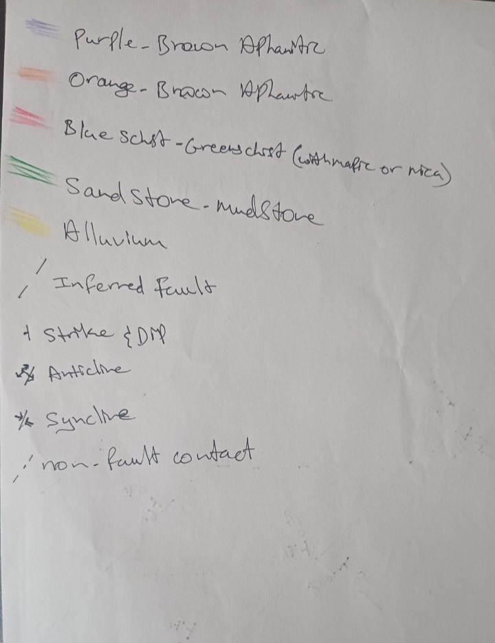
The images of the lithology below dominate the study area and functions as reference of our Geologic Maps & Cross-section.
Collectively, the lithology of this study area are:
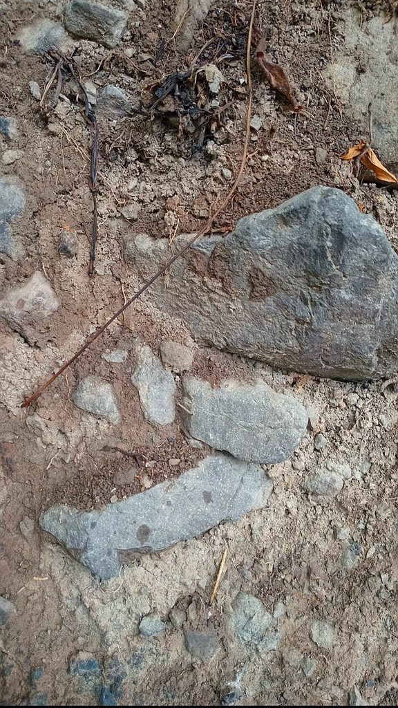
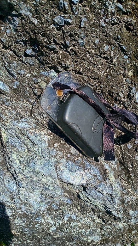
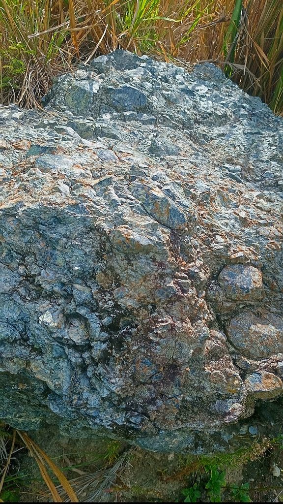
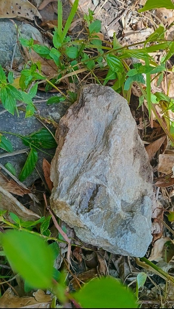
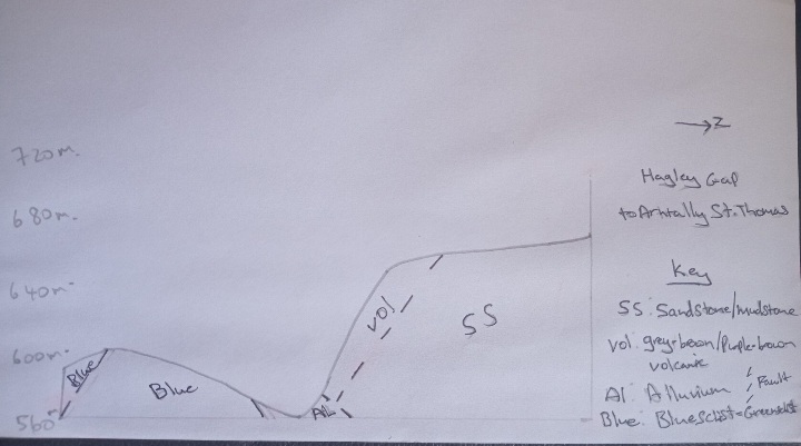
These geologic maps are for the entire area traversed: Mavis Bank, St. Andrew, to Cedar Grove, St. Thomas. The Cross-Section is for Hagley Gap-Arntally Route. This route was selected for the cross-section because it captures a wide range of lithology with structural geology features. This helps with establishing and interpreting the geologic history of the study area.
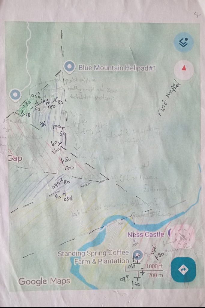
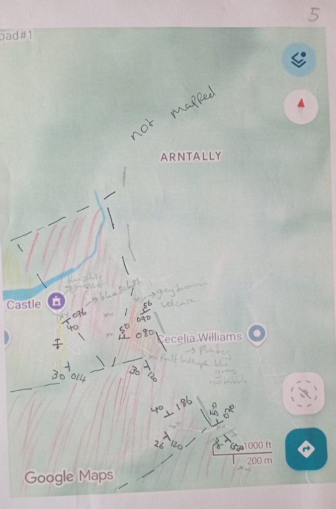
Joinobfitness.com (Blog)
As you can see based on this geologic cross-section, all the lithologies have a relationship with one another, and this relationship is partially as a result of the faults present (potentially all of which are still active. To go further, the shape of the terrain (geomorphology) highlights, mountains, hills and a valley floor. The valley floor is dominated by alluvium. This alluvium is comprised of Sandstone-Mudstone, Volcanics & Metamorphic (Blueschist-Greenschist) rocks. Additionally, you should see that the valley is bounded by at least 2 faults. Those faults are segments of The Plantain Garden Fault. And those fault segments largely control the flow of the Yallahs River.
It can be deduced based on the lithology observed within the field and cross-section, that Volcanism pre-dated the creation of the Metamorphic (Blueschist-Greenschist), Sandstone-Mudstone (sedimentary), and the Alluvium (sedimentary). Using the cross-section, as a reference, I’m of the view that the Sandstone-Mudstone, Purple-Brown & other volcanics rocks, were Protoliths for the formation of Metasedimentary & Blueschist/Greenschist observed. The relatively steeply dipping faults are the likely indicators of past subduction environment. The Alluvium with highlights of thrust faulting (View In Photos Hagley Gap-Cedar Grove for reference) is inferred to be the youngest of the group of lithologies, reflecting the relative young age of the Plantain Garden Fault System as well as it’s mode of faulting (strike slip with thrust), reflecting Transpression tectonism.
Faults, Folds & Jointed rock strata and Slickensides predominate the area.
In terms of fault orientation, the following were observed:
The folds that dominate include symmetrical & asymmetrical antiforms & synforms. Joint-spacing averaged 30mm-50mm. And slickensides with smoothening SW & SE were observed on both sides of the Yallahs River, indicating that the Yallahs River & tributaries is the major boundary between the two major blocks of the fault that dominates (Plantain Garden) within this area.
Human residential settlement (communities) within this study area predominate on flood plains adjacent to the Yallahs River and it’s tributaries. And these floodplains sit at the foot of moderate-steep slopes with massive boulders as evidence of past rockfall, and/or flooding on the same floodplain(s). Similarly, the observation of uplifted alluvium (sections of Mavis Bank to Yallahs River Crossing, sections of Hagley Gap & sections of Arntally); as well as the observation of shifted drainage and sunken section of the Yallahs River crossing, sum up the dominant geologic hazards as follows:
The nature of the geologic hazards to homes & other property forms (cars, agricultural land, Air BNBs), is heavily a combination of environmental change (natural and human-related). On this basis, it’s important to note that the nature of environmental change can serve as a precursor/trigger for other geologic hazards to follow.
As an example, evidence of relatively large bush fires (near Mavis Bank & Hagley Gap communities) that resulted in exposed slopes (free from trees and their binding roots); and flood plains) serve as major triggers for geologic hazards in landslides and river flooding/flow restrictions in times of drought (debris damming-related in some sections of the river) to occur. This can result in negative outcomes to community members who depend on the Yallahs River & crossing for their day to day business, and/or the wider Kingston Metropolitan area who depends on the Yallahs River, to supply water to the Kingston Metropolitan Area.
On the angle of home construction, the good observed was the usage of concrete material with steel. The questionable however, resides in:
These observations bring into question the enforcement of building codes in respect to the geologic hazards and risks, on the part of the relevant municipal corporations, and other relevant Governmant of Jamaica agencies, at the parish level.
To you the resident, community or entity with interest of settling/developing within this study area, you should ensure you are aware of the geologic hazards within reach of your property of interest (use our geologic maps herein as reference). Similar recommendation is applicable to the Municipal Corporation of St. Thomas (permit granting and similar level).
As stated earlier, the rate of environmental change is relatively high. On this basis, whilst the usage of our geologic maps can hold, supplementing with the Site Investigation services of a Geologist on the ground, ideally prior your construction has begun, is also recommended.
First Aid
Have a first aid kit which includes….For ease, shop our recommended first aid kit.
Potable Water
Have enough containerized for…
Food
Tinned. Dry or packaged Energy-dense:
Light & Power
Batteries. Flashlight (solar-powered, regular battery). Power Bank.
Safety Gear
Water Boots. Water-proof casing for personal documents (Gov’t issued ID), Home Insurance documents
Where you see big boulders, avoid building your home there. If you have to live there, be on the ready for rockfall during heavy rainfall and/or earthquakes (even minor). Reference our geologic maps section for further insight.
If you reside in, or intend to develop within this focus area, it is recommended you query & have for your home, coverage for Earthquakes, Rockfall/Landslides, Flooding & Fires.