Fixing Easington Bridge-St. Thomas | Geology Reality
Author
Oshane Bryant
Date
November 14, 2026
Share
[article_adsense]
Filter By Category
Stay Updated
Subscribe to receive all updates on O’Shane Bryant Fitness Limited.
Better Nutrition. Better Habits. Better Living
Exercise 28 Days Beginner & Senior-Friendly
Be Prepared -Awareness
California 2025 Population Change
Menopause Treatment New Guidance | Exercise…
Easington Bridge, St. Thomas: The Current Situation
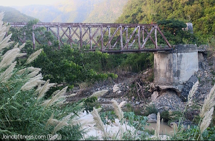
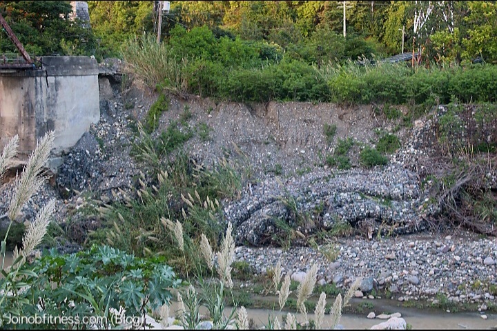
When I visited the Easington bridge from Woodbourne, on October 17, 2026 I observed debris blocking the entrance to the bridge and a “road closed” sign. I also observed signs of river bank erosion, as well as sediment removal underside the base (foundation) of the bridge. What also caught my however, was the ‘fan-like’ appearance of apparent river stones from within the base (foundation) of the bridge.
View of Easington Bridge from Woodbourne road, with eroded foundation & back section, coupled with debris-fan deposit.
It was clear to me at that point in time, that this bridge was experiencing significant wear and tear. Similarly, It was also apparent to me that this segment of the Yallahs river highly erosive, with heights during high flow most-likely reaching the full height of the abutment.
Erosion of river bank protection (gabion basket), revealing the alluvium material that makeup the river bank. The erosion of the river bank is also proof of the river height in time of flood.
Sinkhole Observation-Easington Bridge
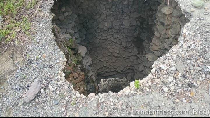
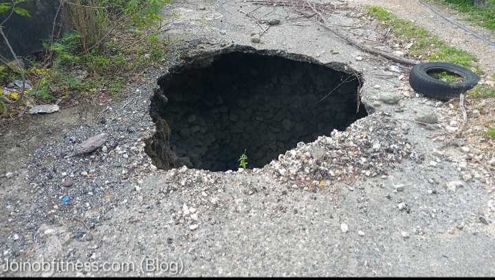
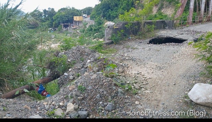
It was on November 8, 2026 while conducting my earthquake geology mapping of Heartease-Easington, that I observed a sinkhole mere meters before standing on the bridge deck.
Sinkhole depth & eroded apparent river stones (deposited at the base) that formed part of the foundation of this bridge.Sinkhole size. The car tire is perfect for scale reference.Highlight of pipe relative to location of sinkhole. Note also the removal of debris at the location of the pipe–more than likely occured during updating of the piping system.
Upon closer inspection, I was able to note the following through observation:
The presence of rounded river stones which apparently function as part of the bridge foundation.
The deposition of rounded stones from within the abutment of the bridge, with some having escaped outside. And the hollow cavity that remained (sinkhole).
Exposed rusted vertical metal at the foundation level-apparently members of the Abutment inner concrete structure.
Water pipe system: with water from the pipe escaping unto the rounded stones still intact within the bridge Abutment–potential contributor to internal weakening of the cement structures (think chemical weathering/erosion due to slightly acidic nature of water) binding the stones together. This more than likely is a weakening agent of the bridge from within.
When Was The Easington Bridge Constructed?
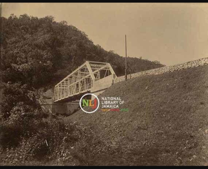
According to The National Library of Jamaica, The Easington Bridge was constructed in the period: 1890-1895. However, this date is not concrete.
As per an excerpt in The Jamaica Star (June 2020): “This bridge deh here from bout inna the 80s”.
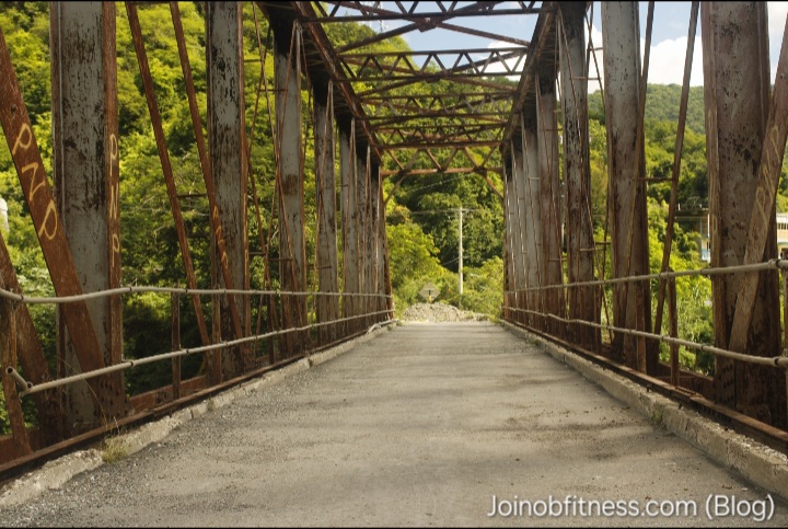
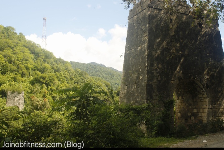
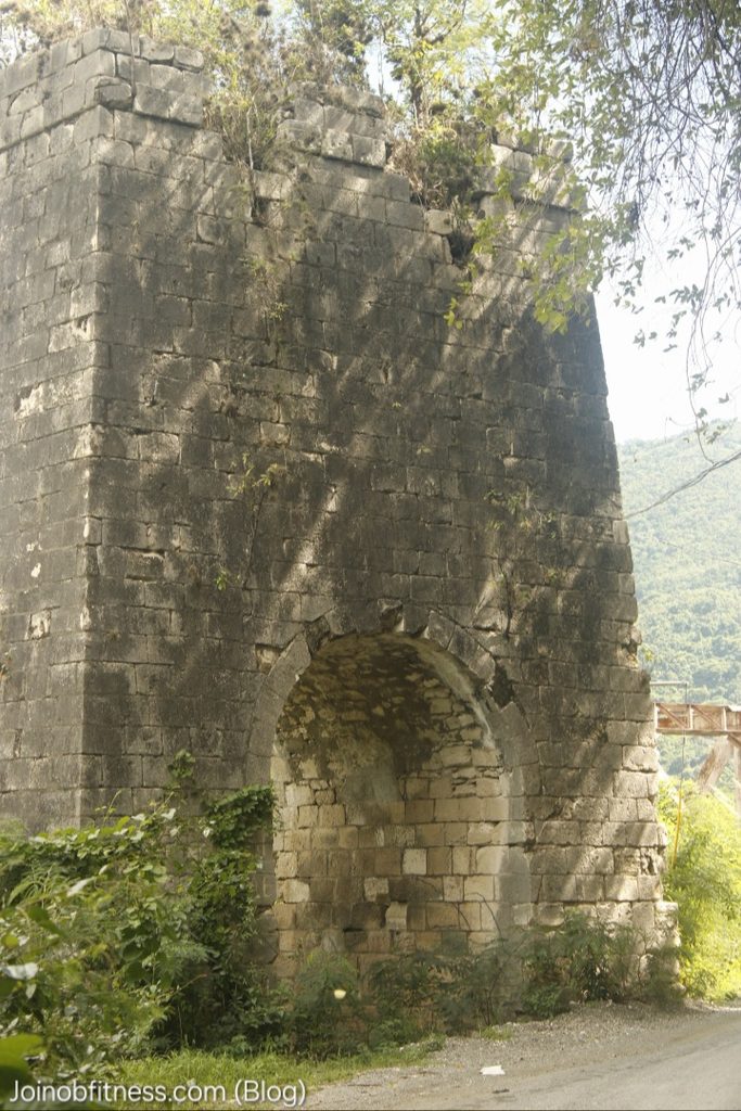
Based on this account, combined with my observations of the National Library of Jamaica Easington Bridge photo, and my photos of the now closed bridge, as well as 2 concrete towers; I’m of the view that this most recently closed Easington bridge, is the second one built.
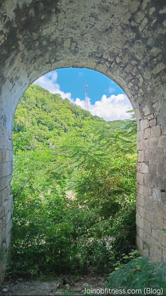
“Yallahs River Bridge at Easington, St. Thomas, Jamaica,” National Library of Jamaica Digital Collection , accessed November 13, 2026, View from the center of Easington Bridge.Cut Carbonate/Limestone formed Towers on both sides of Yallahs River,beside Easington BridgeCloser view of cut carbonate tower with apparent underpass for foot traffic.Underpass view of the cut carbonate tower. Partially covered by foliage is the other tower (across the river).
Earthquake Geology & Hydrology Considerations of Easington-Bridge Repair Must Know
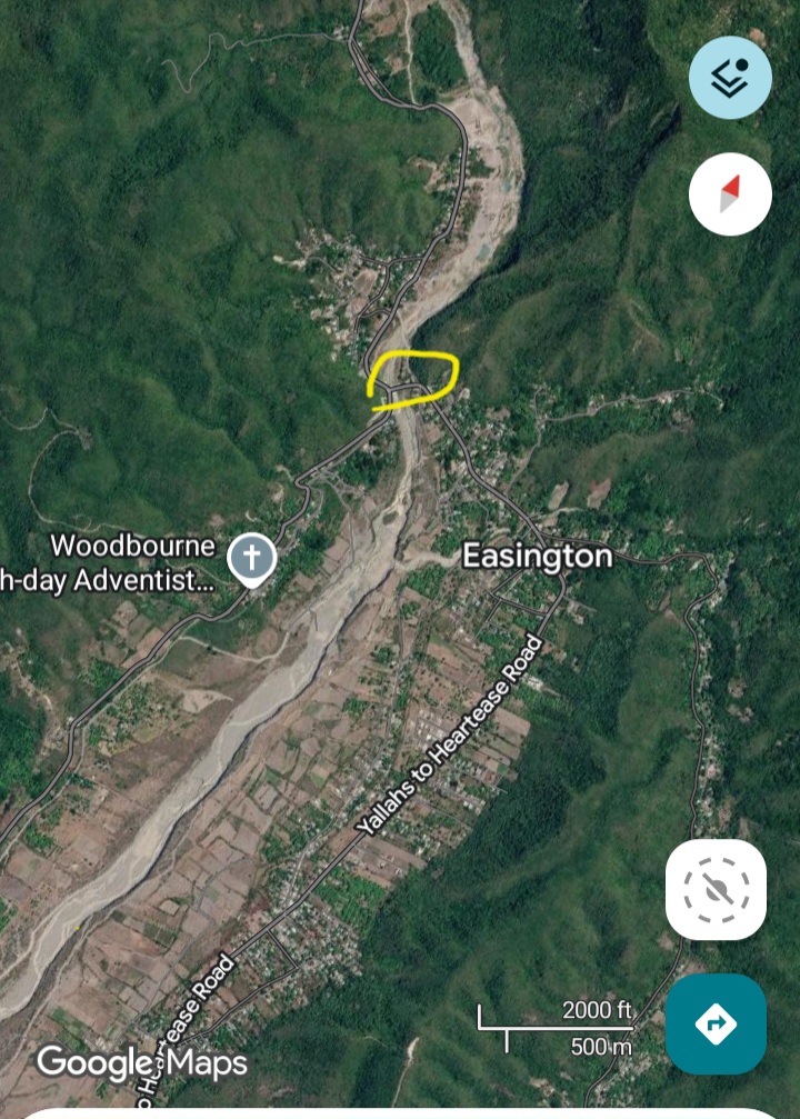
My geologic mapping of the area (within 3km radius) surrounding the bridge highlighted faults and folded strata on both sides. The general lithology underlying the bridge is comprised of Alluvium & Carbonates. My inspection of satellite and terrain imagery surrounding the bridge highlight:
Lateral shifting on the pathway of the bridge.
A relatively wide alluvial plain approximately 3-5x the width of the stream apparent baseflow.
Satellite imagery highlighting the Easington bridge (circled in yellow), and the immediate landscapewithin an approximate 2km radius. Note the relative dense location of the population on and near the Yallahs-Heartease Road. This is a section of the Yallahs River past and current flood plains (high flood risk)…
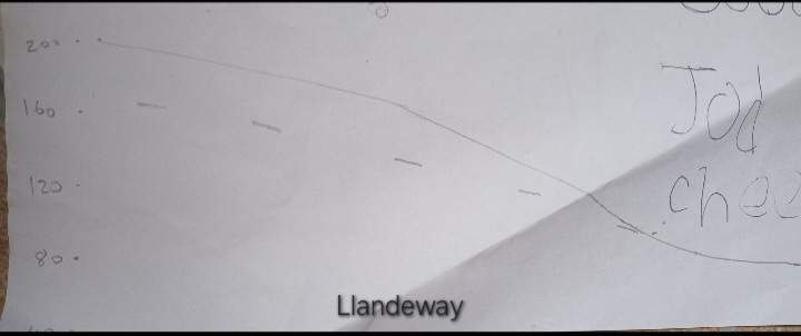
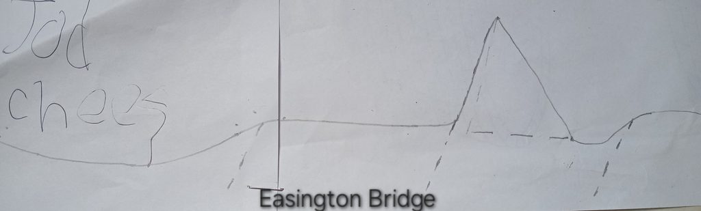
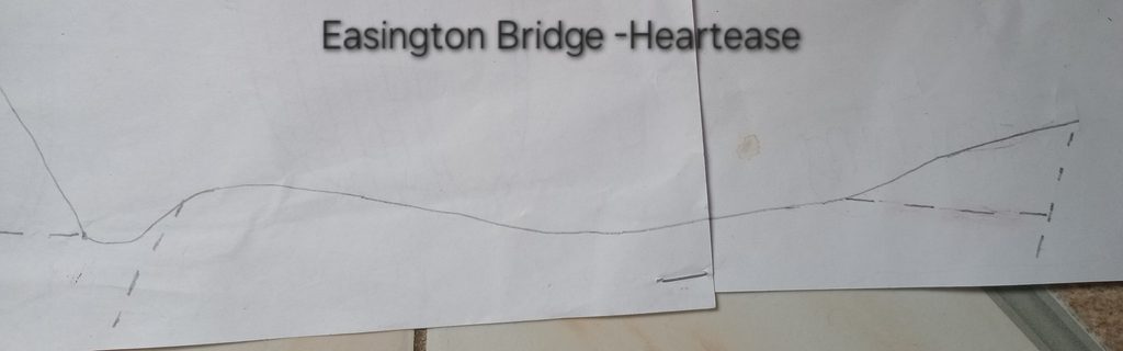
When I created my terrain cross-section with a transect trend of west-north-west to east-south-east (Llandeway, through the bridge to a section of Heartease-Easington road), it became apparent that the Plantain Garden Fault segments are active. These faults have a dominant East/West Trend. Also present are faults (most likely attributed to the Yallahs Fault system) steeply dipping with a dominant North-West/South-East trend.
General Terrain Cross-section: Llandeway-Heartease via Easington Bridge
Combined, these fault systems or segments of their respective systems, are significant contributory factors of:
Yallahs River route and erosive/deposition characteristics-particularly at the Easington Bridge site.
Continuous lateral shifting of both sides of the river (Woodbourne-Easington section & Heartease-Easington section). This lateral shifting presents the increased bridge, seismic-engineering relevant challenge & need of collecting: seismic movement rates (per annum); and seismic loads data specific to non-earthquake and earthquake slip, among others.
Likewise, thorough hydrology and hydrogeology data of the Yallahs river specific to the location of the new Easington Bridge construction will have to be factored. As already mentioned, this Yallahs river through the evidence of alluvium observations (river bank height, sediment sorting…), coupled with the scouring of the bridge base, has a high erosive capacity.
But these are not the only factors that must be captured and interpreted. We now have Climate Change and increased population pressure, coupled with landscape change (more man-made infrastructure such as housing, roads and less trees) as other factors that can further strengthen the erosive force of this river on the bridge and nearby river banks within the short-medium term (lifetime of the new bridge). These will also have to be factored.