
single post
Subscribe to receive all updates on O’Shane Bryant Fitness Limited.





After going through multiple trusted (international) media sources, inclusive of: Reuters & CBC, the general takeaway is the relative minor damage to buildings and other infrastructure, in locations such as Panama City.
This is a remarkable reality, especially when we take this outcome in relative context to the Venezuela, 2026 Mg 7+ earthquakes. A reality such as this for Panama, warrants commendation for its building regulations; and the enforcement of same by contracted building professionals & contractors.
But there is a missing gap that gives further insight into why Panama has experienced relatively minor infrastructural damage. And this gap I sum as:
Geography & Geology.
According to The United States Geological Survey (USGS), the epicenter of the Panama Earthquake main shock (Mg 7+) is 10-12km West, South-West from Pitaloza Arriba. Using maps provided by The USGS and Google Maps, this positions the epicenter to be near the coast of a section of the southernmost extent of Panama.
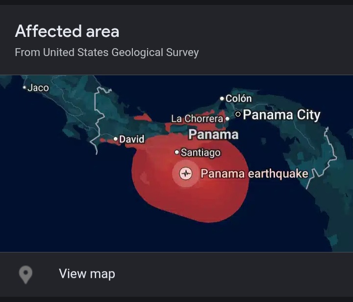
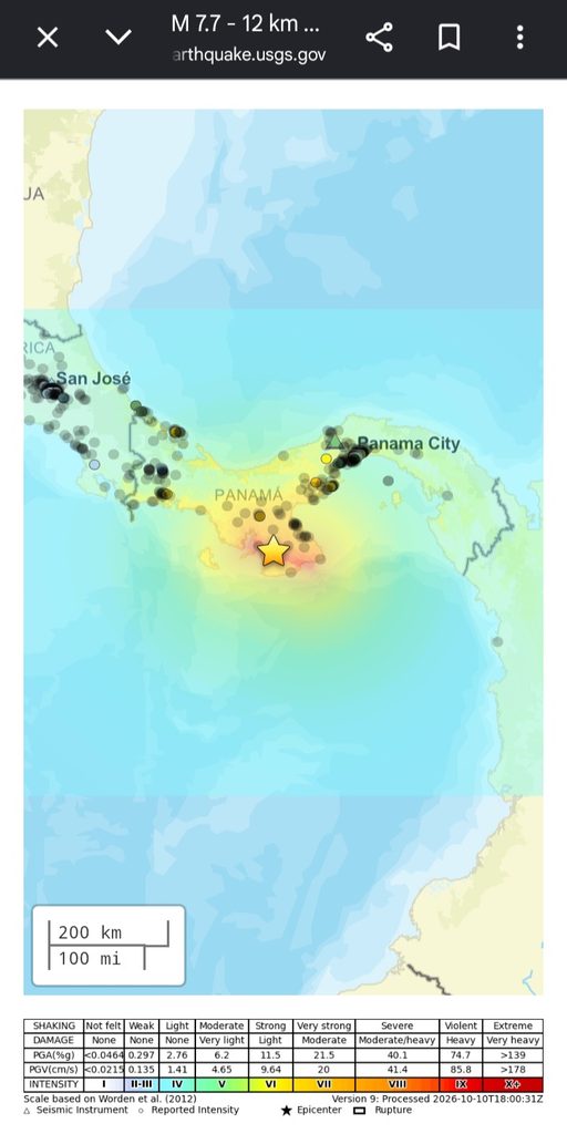
The significance of highlighting the epicenter positioning, is closely linked to geographic distance to key municipalities like Panama City, and the intensity of the earthquake. As I’ve shared in my earthquake video covering Jamaica & Japan similarity, Intense shaking (Mg 7+) extends to a horizontal range of approximately 100km. As you can see in the image below, Panama City is over 200km away from the epicenter of intense shaking. This therefore gives strong support of the relationship between location of the municipalities to earthquake epicenter as a strong factor for earthquake intensity & related seismic loads on buildings.
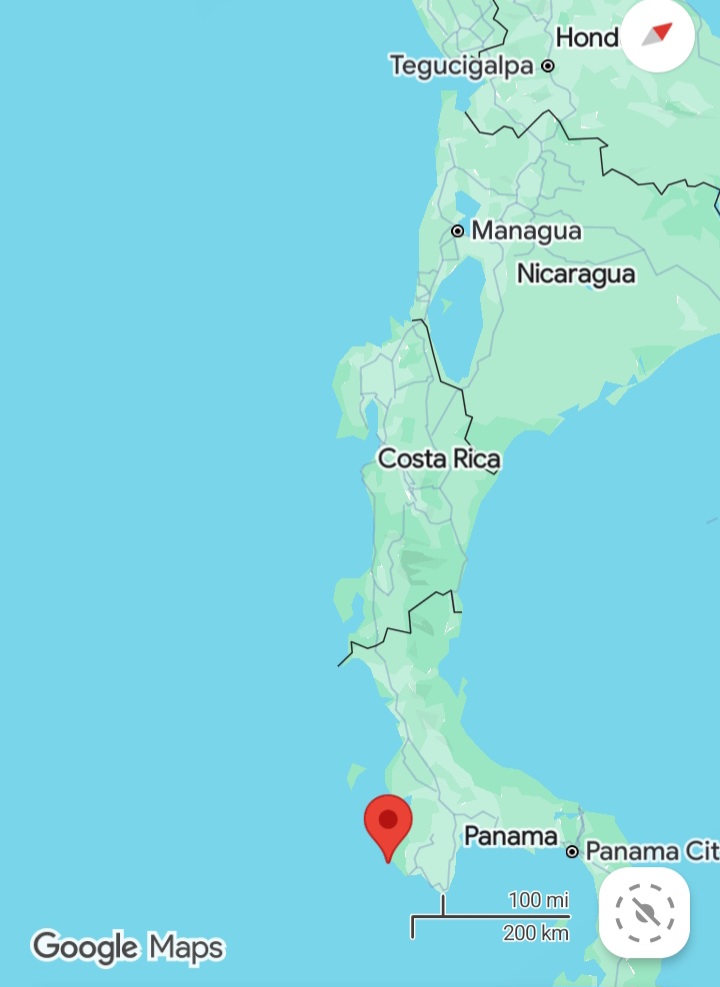
By this point, you should have a better understanding of the Geographic relevance of the earthquake epicenter to the densely populated areas, as an explanation of the relatively low damage to buildings. The other key factor (specific to the focus of this article), relates to Geology.
As Google AI states, Panama is dominated by Volcanics. When I observe the Terrain map of Panama City, what stands out is the relative undulating surface, indicative of non-uniform rates of weathering/erosion of the geologic basement of Panama City, which serves as foundation for the buildings within and surrounding the municipality.
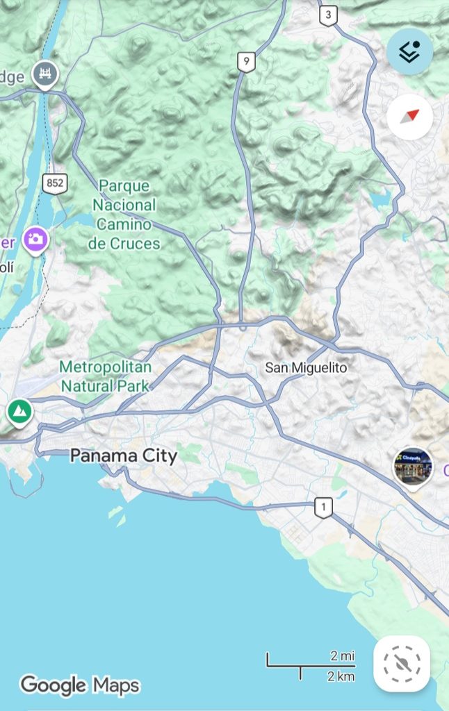
This is a significant insight, because what this indicates is that the geology of Panama City it not as great an amplification of Earthquake forces, in contrast to widespread unconsolidated sediments of Alluvial Fans/basins, that make up the La Guirra area of Venezuela, Disastrous Mg 7+ earthquakes, also in 2026.
The reveal of the Geologic & Seismic Data by the USGS, combined with the Spatial Data of Maps (both highlighted herein), serve as strong explanation- in combination with the strong regulatory environment & building practices- for Panama’s relatively minor damage experience, of buildings and other infrastructure in major municipalities across the country.
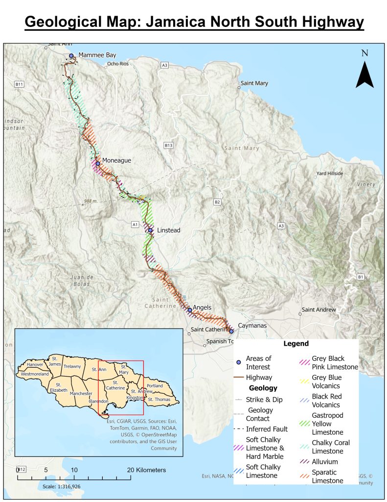
And this case, strongly supports the relevance of our Earthquake Hazards Mapping Project, Jamaica.
You must be a OB Fitness Web Chat Room member to access this content.