

The Restraining Bend of The Plantain Garden Fault Zone: Active in St. Andrew, Jamaica
On September 5, 2026, I conducted my field geology mapping within sections of rural St. Andrew which included the areas/communities of:
- Golden Spring.
- Mount James.
- Temple Hall
- Zion Hill.
- Toms River.
- Lawrence Tavern.
- Mt. Ogle.
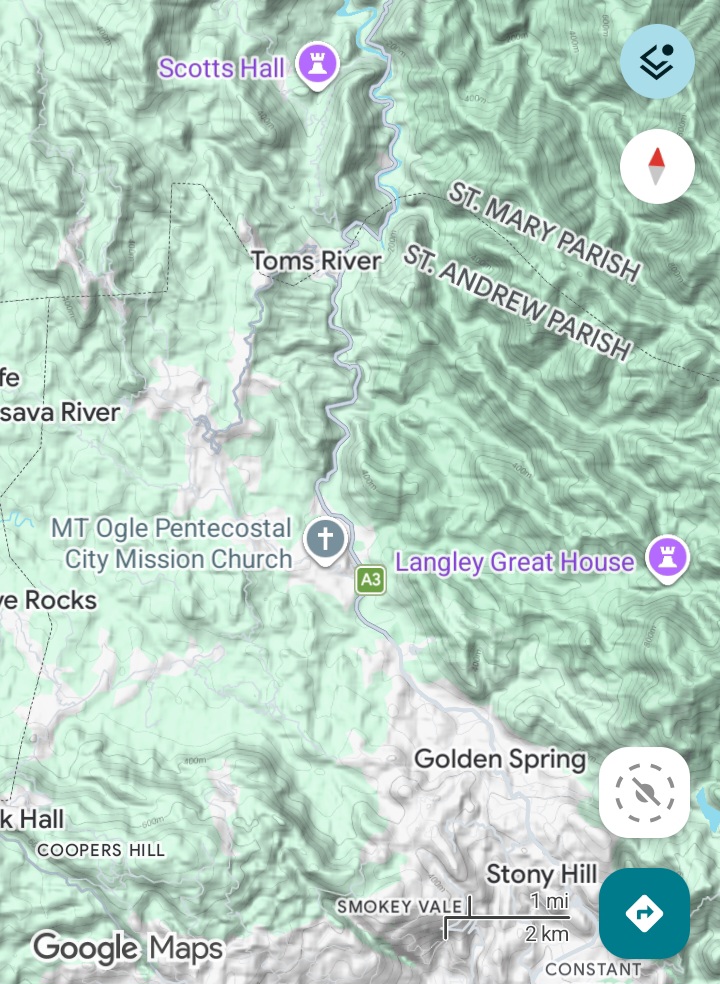
Google Terrain Map highlighting most of the communities and mapping area covered.
Throughout this area, I observed damaged infrastructure in the form of cracked & bulging walls.
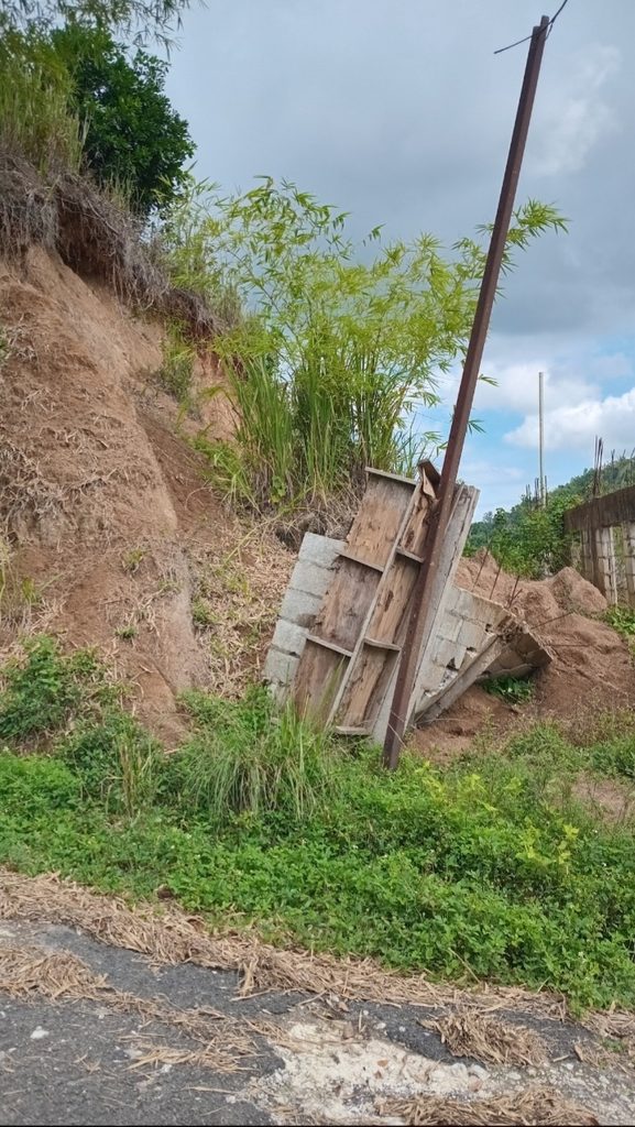
Near Tom’s River

Oberlin High
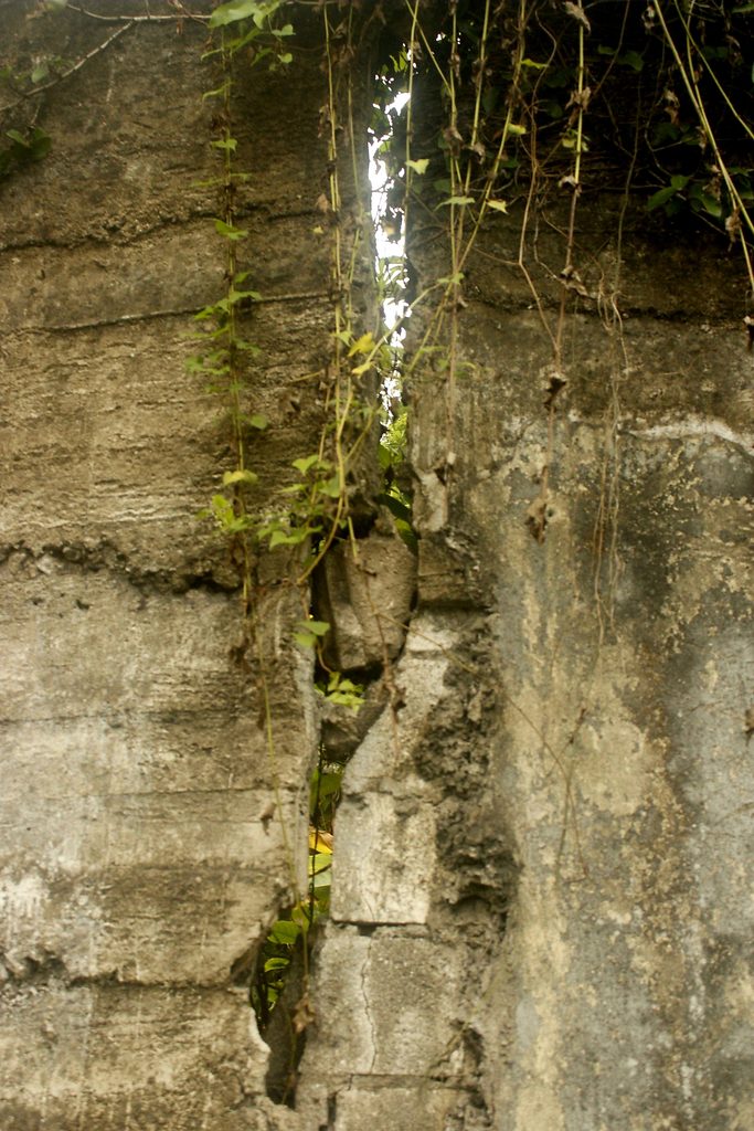
Golden Spring
The cracked wall specifically at Oberlin High School, was most striking, because it is very recent (since 2008). I graduated from Oberlin High in 2006, and was actively back and forth up to 2008, assisting with the preparation of the Cheerleading as well as Track & Field teams. The wall of focus, was painted over after then. And as you can see, the crack is younger than the painting. What is clear/relatively easy to conclude, is that based on my field observations alone, this overall study area is sitting within an active fault zone. What isn’t clear, among other things are:
- Whether or not the damaged infrastructure observed across all locations, is indeed as a result of an earthquake or aseismic creep.
- If an earthquake is the causative factor, which earthquake (in date, magnitude and focal depth), is/are responsible.
Nevertheless, what cannot be disputed is the reality that infrastructure like in other areas we have covered in our previous reports, are experiencing weakening due to geo-forces, potentially predominantly seismic in nature. With this being highlighted, lets delve deeper into this, our report.
View Our Other Reports Covering Kingston & St. Andrew
Lithology
Geologic Maps-Seismic Location
Relevance & Value of Geology Maps to Public Safety
These geology maps can help you visually identify the locations of fault segments specific to The Plantain Garden & WagWater Faults, in relation to your property/infrastructure of interest.
As the images below highlights, as well as this report as a whole, Oberlin High School, as well as the entire area herein, is within reach of active segments of the mentioned major faults. And these faults have produced moderate earthquakes (2024).
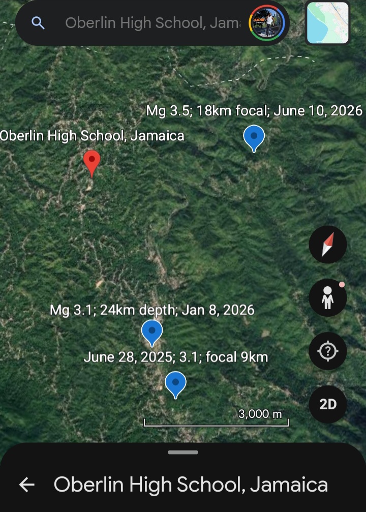
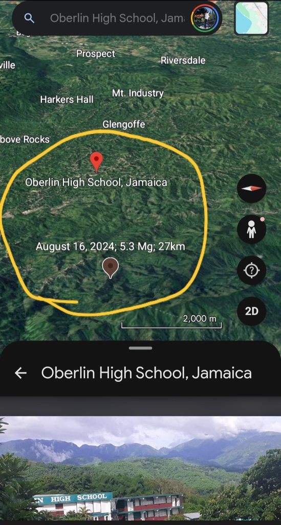
By using these maps as references/tools, you as a layman or professional, are better informed in your intended hazard/disaster management plans relating to your property/community/constituency.
Geologic Maps: Fault Lines Focus
Explanation & Terrain Observation of the Restraining Bend
The restraining bend can be understood as the morphological expression of major strike slip faulting that can be grouped as The Plantain Garden Fault Zone. “The interaction of the interplate strike-slip fault system (Enriquillo- Plantain Garden fault zone) and the oblique rifts has shifted the strike-slip fault trace c. 50 km to the north and created the 150-km-long by 80-km-wide restraining bend that is now morphologically expressed as the island of Jamaica.” (Mann, Demets, Grandison, 2007)
There are two areas (at parish scale in Jamaica), whereby the restraining bend is present: sections of St. Andrew, Portland & St. Mary-border regions (as highlighted in this report).
And sections of St. Elizabeth, Trelawny & St. James.
Terrain Observation
Specifically, the segment of the restraining bend within the parishes of St. Andrew, Portland & St. Mary, is dominated by mountains 600m-1400m above sea level; hills between 300m-600m above sea level; and alluvial valley floors/plains between 260m-300m above sea level.
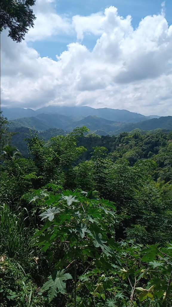
Terrain View from King Weston, St. Andrew. Highlighting hills, mountain range & valleys.
This terrain overview highlights a mixture of compression (mountain building) and extension (elevation drop yielding valleys & plains). Thus supporting the theoretic depiction of Transpression and Transtension.
Construction Practices Observed & Concerns
For the areas covered in this report, commercial (concrete block factory, business districts) were observed in Golden Spring, Temple Hall & near Belmont Road. These business establishments generally are 1 storey in height.
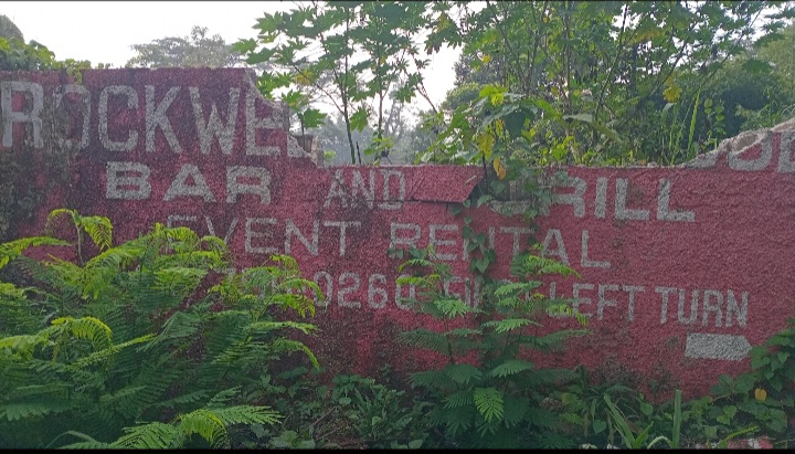
Damaged Perimeter Wall advertising Concrete Block Factory in Temple Hall, St. Andrew.
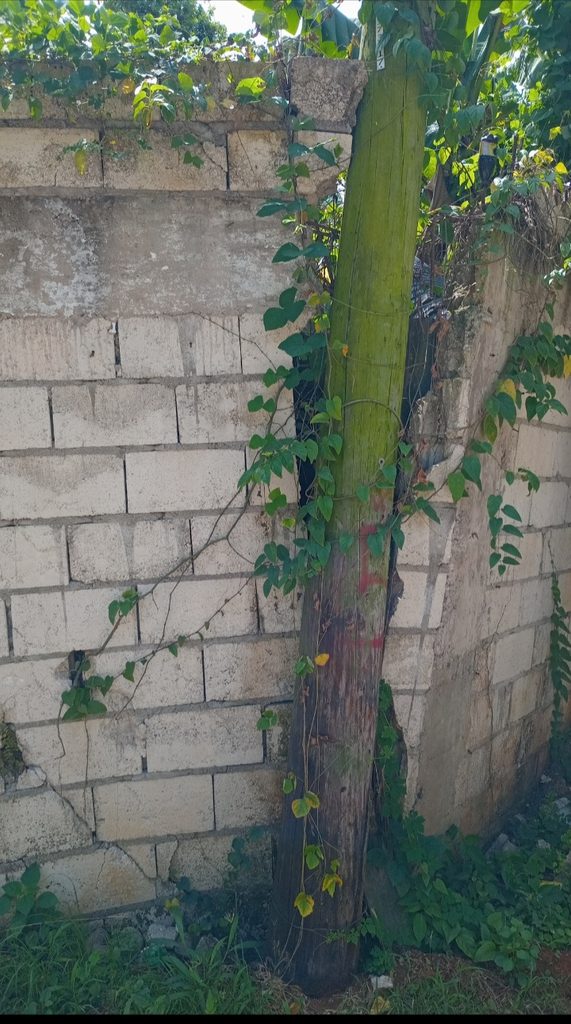
Perimeter Wall of Concrete Block Factory near Belmont Road, St. Andrew.
Residential settlement pattern depict 1 storey- 3 storey homes/properties. Within the communities of King Weston & Mt. Ogle as examples, what was also observed were homes with apparent reinforced concrete pillars.
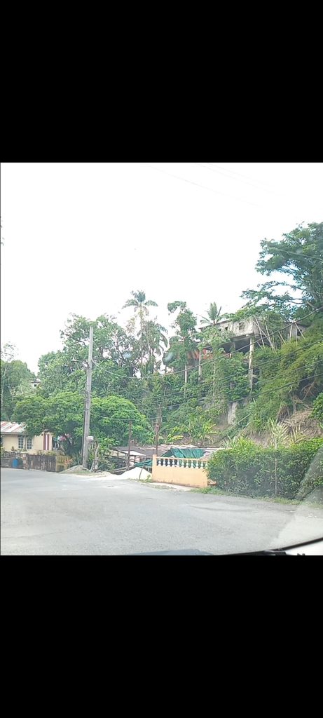
1 Storey House on Pillars in Mt Ogle St. Andrew.
This observation was most prevalent for the homes on moderately sloping terrain.
Given the close proximity of active fault segments of both the Plantain Garden & Wagwater Fault zones; as well as the dominant lithology (Granitoid) that weather into Sandy-Silt/Silty-Clay soils; the evidence of weakening infrastructure (cracks on perimeter/retaining walls) in Lawrence Tavern, Temple Hall & Mt. Ogle respectively; as well as the reality of recent (2024 & 2025) landslides within the areas of Track Gate & Mt Ogle, it’s reasonable to state that this construction practice is very concerning, and not recommended.